thecajuns.com
|
| Genealogy Reports | Surname Reports | Militia Rosters | Census Records | Acadian Exiles & Prisoners | Genealogy/History/Food Books & Music CDs | Ship Records |
Acadia during the 17th Century
Minas Basin 1693 with Names of Settlers
Port Royal, Beaubassin, Grand Pre, etc.
See Books page for map of Quebe
El Camino Real de los Tejas - Louisiana: The old highway ran from
over 1600 miles from Los Adaes [present-day Robeline, LA] to Mexico City
The Louisiana Acadian Coast
Divisions of the original Attakapas District
Division of Territory of Orleans into Counties in 1805 &
Map of Attakapas County
Iberia Parish
Map of Route Taken from New Orleans to New Iberia by Malaguenos Settlers
Map of Louisiana Parishes, Map of the Tourist Regions and List
of 22 Parishes Known as The Acadiana Parishes
List of Louisiana Parishes with Parish Creation Dates, Created From and Parish Seats
Map of the Bayou Teche [Source: acadiana profile The Magazine of the Cajun Country, Vol. 29 No. 4 June 2010, p. 34]
River Road Map -
Map in PDF of towns, communities, settlements, etc. along both sides of the
Mississippi River from Baton Rouge to New Orleans
Old-New Place Names in Louisiana
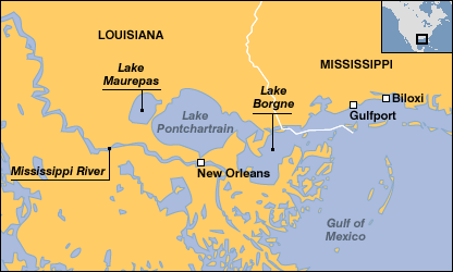
Map of SE Louisiana and Mississippi Gulf Coast showing: New Orleans, Mississippi River, Lake Maurepas, Lake Pontchartrain, Lake Borgne, Gulf of Mexico, Gulfport and Biloxi
Map of 10 parishes in the Greater New Orleans area:

Greater New Orleans area showing English Turn

From The Second Voyage to the Mississippi, The Journal of the Renommee by Iberville
"...From Cape San Antonio I steered for the Biloxy Bay anchorage, at which I arrived on January 8, 1700, and moored with two anchors in 21 feet of water.
The 9th. In the morning M. De Sauvolle came aboard. I learned from him that the garrison was in good health, although four men had died, among them two Canadians, one buccaneer, and one enlisted man for La Rochelle.
He told me that an English corvette of ten guns, commanded by Captain Louis Bance, had entered the Mississippi and gone 25 leagues upstream, where my brother, De Bienville, with five men in two bark canoes, had come across the corvette at anchor, awaiting favorable winds to go higher upstream. My brother sent two men to tell him to immediately leave the country, which was in the possession of the king, and that, if he did not leave, he would force him to. With this he complied after talking with my brother, whom he knew from having seen him with me at Hudson Bay, where I captured this captain."
Hainaut (Origin of the passengers on La Loire, the Louisiana Mayflower)
Canary Islands
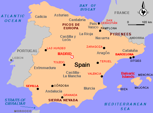
Malaga, Spain
San Sebastian, Spain (Basque area)
Belle-Ile en Mer - Under English
control when the Acadians were exiled. Returned to French control in the Treaty
of 1762. On November 8, 1765, 78 Acadian families arrived as settlers.
The declarations made by these Acadians provide links back to their ancestors in
Acadia.
Map of French Provinces before 1789
Revolution
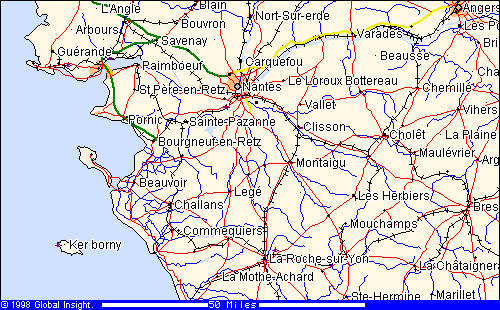
Nantes
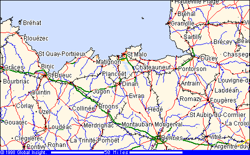
St. Malo
West Indies: Greater and Lesser Antilles
| About the Host | Visit Louisiana | The Acadian Memorial & The Acadian Museum | The Cajuns is on |
Home |